
We all know that GPS is a very useful device to avoid traffics and accidents too. However, the maps shown are usually not literally photography but are rather drawings, which make it difficult to understand landmarks. How about owning a GPS unit that uses real photography, real world streets and cities for navigation?
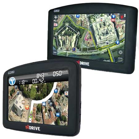
NDrive has announced the availability of two new outstanding GPS navigation systems, known as G280 and G800, claiming to be the first GPS navigator using real photos of the UK and Ireland as well as other European maps. Certainly, the devices are coming in the UK.
The G800 incorporates a 4.3-inch screen supporting aerial view, 8GB memory, FM transmitter to listen to car audio, Bluetooth receiver for calling, games and calculator. Additional multimedia functions include plays music, videos, watch photos and read e-books.
In the G280, you get to access 8GB internal memory, calculator, games such as Bubbles and Breakout games, and multimedia player for playing music, videos, viewing photos and reads texts; along with locations of speed cameras.
Scheduled to release later this month, the NDrive G800 costs 350 EURO (approx. Rs. 22,330) and NDrive G280 retails for 250 EURO (approx. Rs. 15,950).


